Ever since Native Americans blazed the first trails through the wilderness, Californians have been hikers. Oceanside rambles, desert palm oases, skyscraping peaks and silent forests await. Here are 10 of California’s best hiking trails.
Editor’s note: Please check the latest travel restrictions due to COVID-19 or the California wildfires before planning any trip and always follow government advice.
Rubicon Trail
A hugely scenic trail on Lake Tahoe‘s western shore. It ribbons along the lakeshore for 4.5 mostly gentle miles from Vikingsholm Castle (add a mile for the downhill walk to the castle from Hwy 89) in Emerald Bay State Park, then leads past small coves perfect for taking a cooling dip, and treats you to great views along the way.
Add an extra mile to loop around and visit the restored historic lighthouse, a square wood-enclosed beacon (that looks a lot like an outhouse) constructed by the Coast Guard in 1916. Poised above 6800ft, it’s the USA’s highest-elevation lighthouse.
Mist Fall Hike
This very enjoyable 8-mile, round-trip walk along the riverside, up a natural granite staircase and finishing at the falls, which (when the wind is right) blows refreshing water droplets at hikers on arrival, highlights the beauty of Kings Canyon. The first 2 miles are fairly exposed, so start early to avoid the midday heat on the 700ft ascent.
Continuing past Mist Falls, the trail eventually connects with the John Muir/Pacific Crest Trail to form the 42-mile Rae Lakes Loop, the most popular long-distance hike in Kings Canyon National Park (a wilderness permit is required).

Coastal Trail
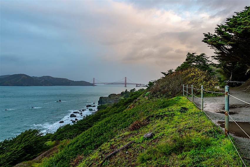
Hit your stride on this 10.5-mile stretch, starting at Fort Funston, crossing 4 miles of sandy Ocean Beach and wrapping around the Presidio to the Golden Gate Bridge. Casual strollers can pick up the restored trail near Sutro Baths and head around the Lands End bluffs for end-of-the-world views and glimpses of shipwrecks at low tide. At Lincoln Park, duck into the Legion of Honor or descend the gloriously tiled Lincoln Park Steps (near 32nd Ave).
High Sierra Trail
A contender for the best trail in Sequoia National Park – it’s definitely on many world’s best hike lists – the High Sierra trail begins at Crescent Meadow and continues for 49 miles. From 6700ft it climbs to an altitude of 10,700ft, crossing ridges, rivers, lakes, waterfalls and offering the most jaw-dropping mountain and valley views. It also connects to junctions for the famous John Muir Trail.

Cathedral Lakes
If you can only manage one hike in Tuolumne, this should probably be it. Cathedral Lake (9588ft), the lower of the two Cathedral Lakes, sits within a mind-blowing glacial cirque, a perfect amphitheater of granite capped by the iconic spire of nearby Cathedral Peak (10,911ft). From the lake’s southwestern side, the granite drops steeply away, affording views as far as Tenaya Lake, whose blue waters shimmer in the distance.
Parking for the Cathedral Lake Trailhead is along the shoulder of Tioga Rd. Due to the popularity of this hike, parking spaces fill up fast, so arrive early or take the free shuttle.
Santa Monica Mountains
A haven for hikers, trekkers and mountain bikers, the northwestern-most stretch of the Santa Monica Mountains is where nature gets bigger and wilder, with jaw-dropping red-rock canyons, and granite outcrops with sublime sea views. The best trails are in Pacific Palisades, Topanga and Malibu. The Backbone Trail is the longest trail in the range, linking – and accessible from – every state park. It’s 67 miles all told, running from Will Rogers to Point Mugu State Park, and can be completed in a few days.

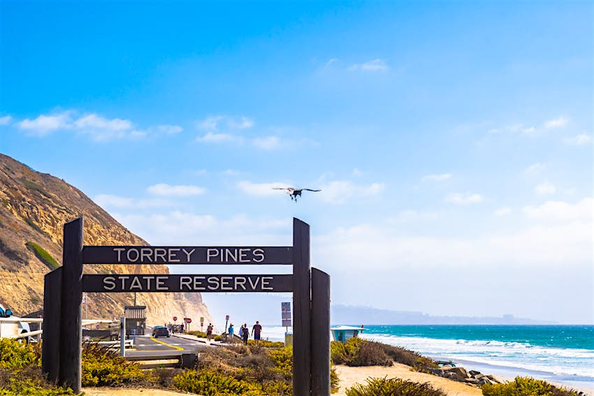
Torrey Pines State Natural Reserve
Walkers and hikers explore eight miles of hillside sandy trails in a wilderness oasis of 2000 acres. Choose from routes of varying difficulties in this well-trodden coastal state park in La Jolla. The 0.7-mile Guy Fleming Trail (currently closed due to COVID-19) has panoramic sea views and paths through wildflowers, ferns and cacti. Meanwhile, the 1.4-mile Razor Point Trail (currently closed due to COVID-19) offers a good whale-spotting lookout during winter months.
Flora and fauna is abundant in this protected area. During quieter times, with fewer stomping feet, quiet walkers may spot raccoons, rabbits, bobcats, skunks and foxes among plenty of other types of wildlife. You’ll have to pay for parking.
Tahquitz Canyon
Considered historic and sacred by the Agua Caliente people, this gorgeous canyon, located in the Greater Palm Springs, can be explored via a fairly steep and rocky 1.8-mile (round-trip) hike culminating at a 60ft waterfall. An interpretive trail guide that’s available at the visitor center points out rock art, viewpoints and native plant life. The center also has natural- and cultural-history exhibits and screenings of The Legend of Tahquitz video about an evil Cahuilla shaman.
Bring a picnic, water and be sure to wear sturdy footwear. If you don’t want to head out on your own, join a ranger-led 2½-hour hike departing four times daily (once daily July to September) from the visitor center.

Boy Scout Trail
For an immersion into Joshua Tree flora and topography, embark on this tough 8-mile one-way trail cutting through canyons, washes and mountains along the western edge of the Wonderland of Rocks. Most hikers prefer to launch from Park Blvd near the Quail Springs picnic area and head north to Indian Cove. Arrange for pick-up at the other end or plan on camping overnight. Part of the trail is unmarked and hard to follow.
Rings Loop Trail
This fun 1.5-mile trail delivers close-ups of the Swiss-cheese-like cliffs of the Hole-in-the-Wall area at the Mojave National Preserve. Starting at the south end of the parking lot, it passes petroglyphs before entering an increasingly narrow canyon that you have to scramble out of using metal rings. You’ll emerge at a picnic area and follow a paved road back to the parking lot. For a shorter experience (0.5 miles), use the rings to descend straight into the canyon and climb back out the same way.
This piece orginally appeared on our sister site, Lonely Planet.
