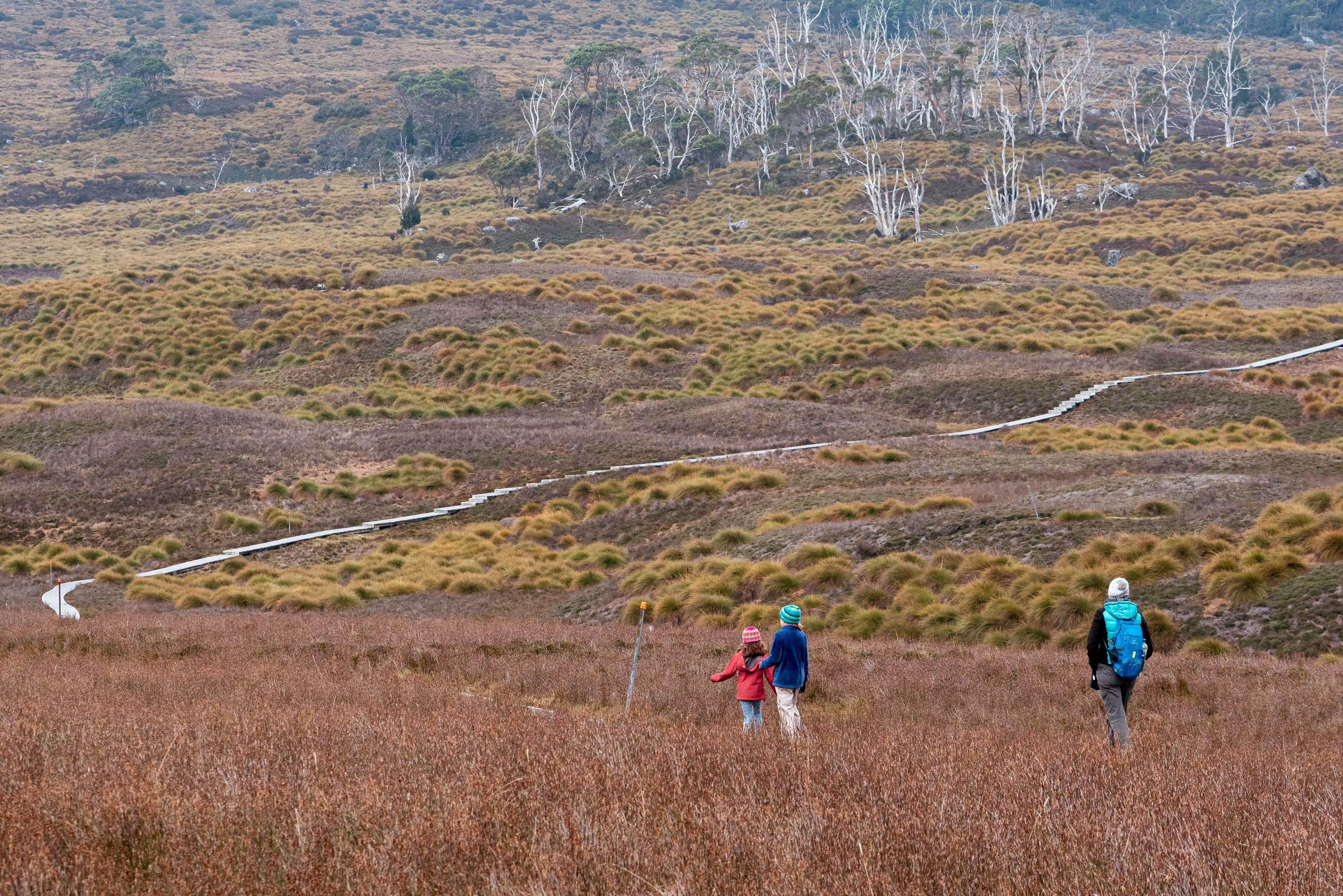
Bushwalking (Australian for hiking) is supremely popular in Australia, with thousands of kilometers of trails lacing its national parks and wilderness areas from the coast to the outback. Great for spotting native wildlife, many trails also traverse culturally and historically significant landscapes, with relics and interpretative trail markers offering fascinating insights into Australia’s unique ecology and 65,000 years of human history.
The best time to lace your boots in Australia varies between regions, with outback hikes best suited to the cooler winter months (April–October), while hiking in Tasmania and the Australian Alps is a more popular summertime activity (November–March). The further north you go, the steamier the climate becomes, with hiking in northern Australia recommended during the May–October dry season.
From scenic day walks to multi-week epics, these are some of the best hikes in Australia.
1. Overland Track
Best multi-day wilderness hike
65km (40 miles), 5-7 days, moderate
A five- to seven-day odyssey through the incredible World Heritage–listed mountainscapes of Cradle Mountain-Lake St Clair National Park, Tasmania’s alpine Overland Track is Australia’s most famous multi-day wilderness tramp.
The well-marked track threads between mountains rather than grinding over them, making the Overland an achievable independent adventure for experienced multi-day hikers with a decent level of fitness. A limited number of dormitory beds at seven hiking huts en route are available on a first-come, first-served basis, with independent hikers required to carry a tent, cooking equipment and food for the entire journey. For more comfort, Tasmanian Walking Company offers guided walks, including all meals and lodging at the only private accommodations on the trail, discretely tucked off the main path.
Most hikers tackle the Overland Track during the warmer months from October–May, when daylight hours are longer, and you can work up enough heat for a dip in one of the frigid alpine tarns. A permit is required to hike during this period, and you can only walk the track in one direction – north to south. But with the permit system allowing just 35 independent hikers to depart on any given day (hint: book early), the trail never feels crowded. You can savor the solitude and icy beauty during a hike from either direction in winter, though freezing temperatures and snow make this an endeavor for expert hikers only.
The trail is extremely varied, negotiating high alpine moors, rocky scree, gorges and tall rainforest, with worthy side-trips including the summit of Mt Ossa (Tasmania’s highest peak at 1617m/5305ft) and some spectacular waterfalls. Wombats and pademelons tend to be the most commonly sighted wildlife; slow down to spot an incredible array of colorful fungi growing along the paths.
2. Kosciuszko Walk
Best day hike for active families
13km (8 miles), 4-5 hours, easy to moderate
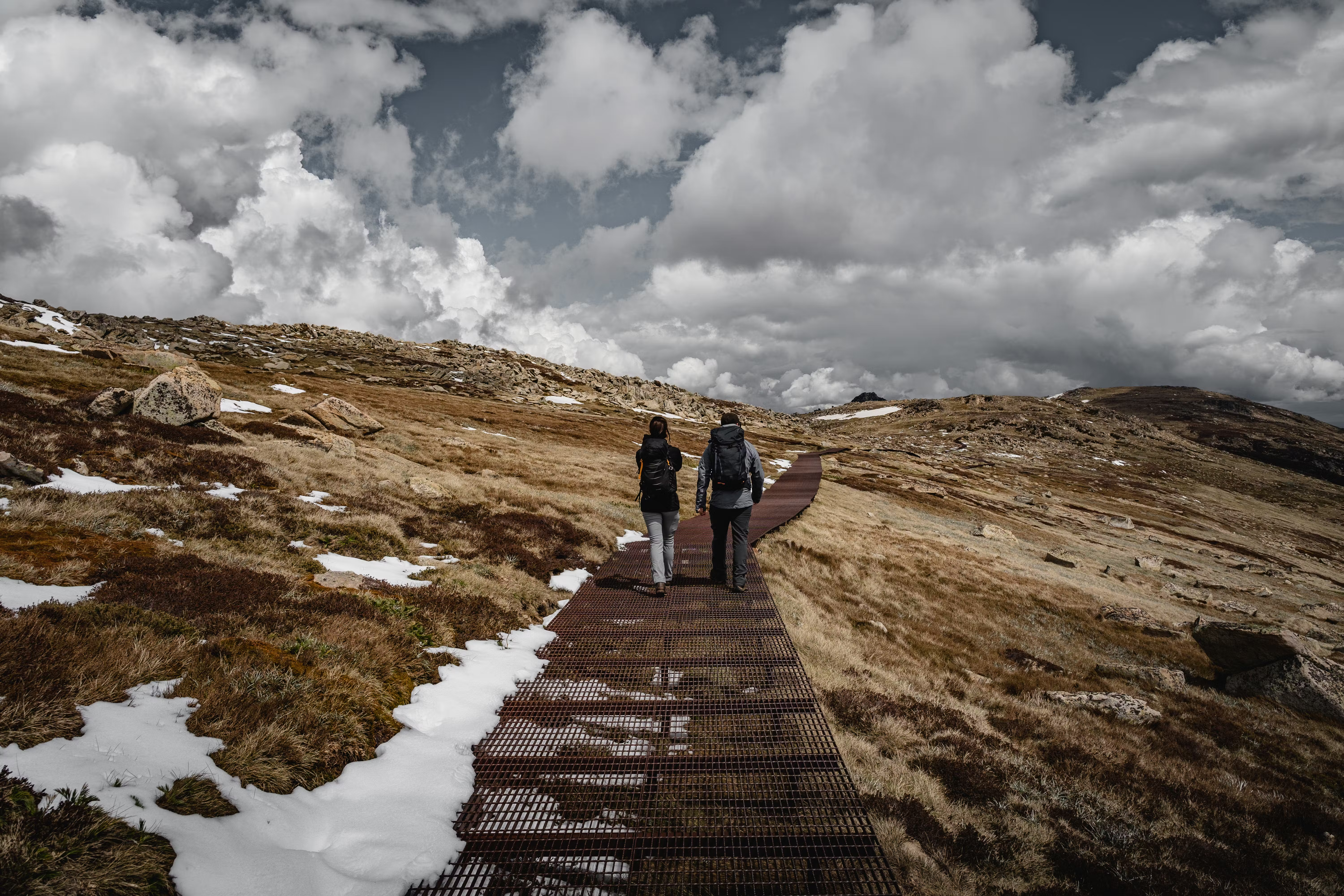
With reasonable fitness, good weather and at least four hours to spare, just about anyone can summit Australia’s highest peak. Named after a Polish national hero by explorer Paweł Strzelecki, Mt Kosciuszko (2228m/7310ft) is the smallest of the world’s seven summits, and it’s relatively straightforward to climb, with raised walkways meandering up to a superb panorama of the New South Wales Snowy Mountains.
There are two routes to the top. The more family-friendly Kosciusko Walk begins in the alpine village of Thredbo with a scenic Kosciuszko Express Chairlift ride, followed by an uncomplicated 13km (8-mile) hike to the summit and back – aim to finish the walk in time to catch the last chairlift at 4.30pm or it’s a steep, 4km/2.5-mile walk down to the village. More challenging is the Mount Kosciuszko Summit Walk, a 16.6km (10.3-mile) return hike from the tiny ski town of Charlotte Pass (allow 7-9 hours), which joins the Kosciuszko Walk at Rawson Pass for the final leg to the summit.
No matter which route you take, the alpine scenery is stunning. Aboriginal groups, including the local Ngarigo people, have had a spiritual connection to this wild landscape for more than 21,000 years. As you survey the wildflowers and glacial lakes en route to the roof of Australia, you’ll easily see why this land has long-inspired ceremony and awe.
Best hiked between late November and February to enjoy the wildflowers, both routes to the summit are snowbound from June to October.
3. Larapinta Trail
Best multi-day outback hike
230km (143 miles), 14 days, moderate/difficult
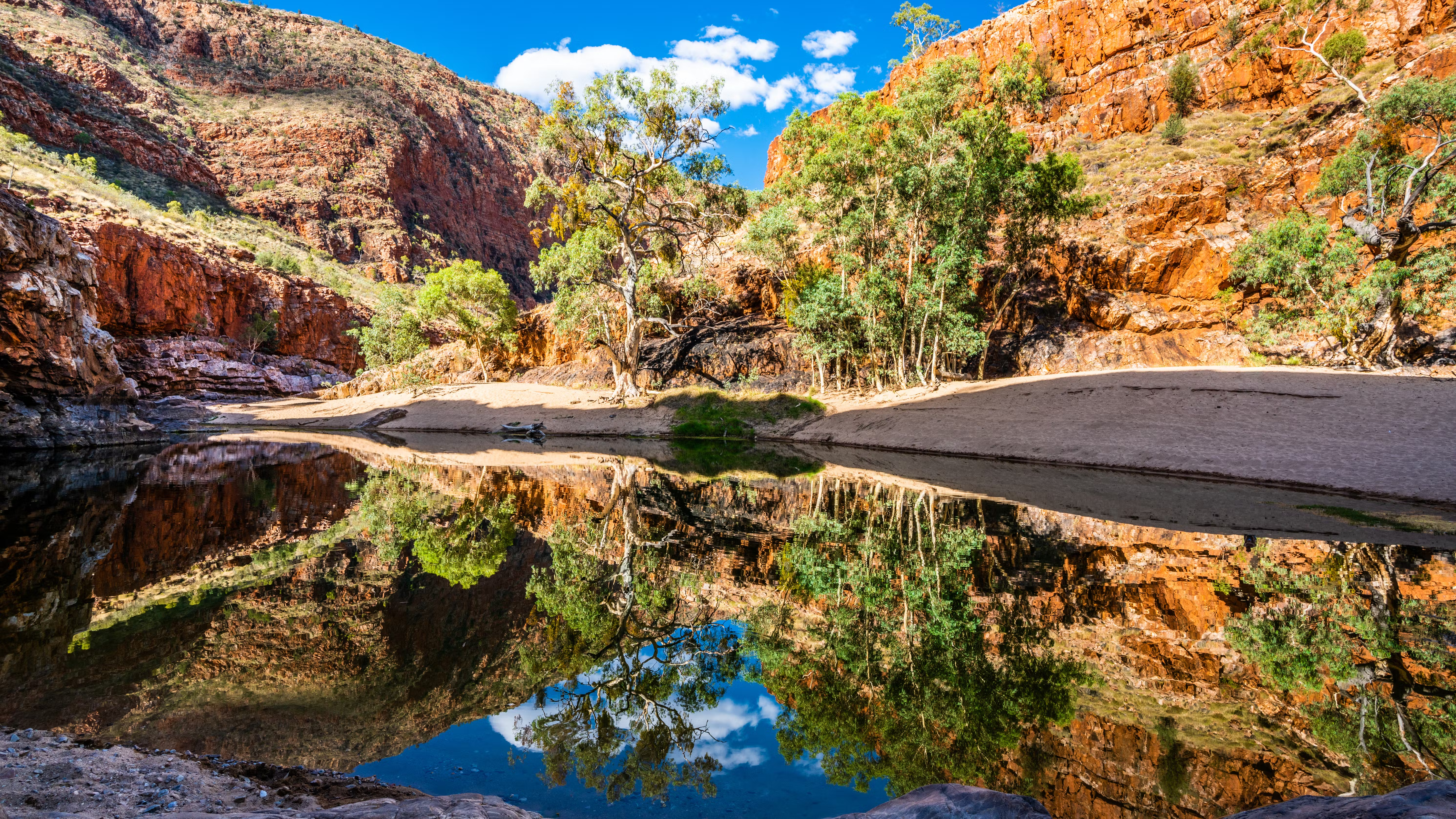
The Northern Territory’s most famous long-distance walk, the Larapinta Trail extends along the backbone of the West MacDonnell Ranges in Tjoritja/West MacDonnell National Park. The track is split into 12 stages of varying difficulty, stretching from Telegraph Station in Alice Springs to the craggy 1380m (4528ft) summit of Mt Sonder on the western fringe of the ranges.
Each section takes one to two days to navigate, and the trail passes many of the natural attractions in this awe-inspiring desert landscape, where you’re likely to encounter day trippers from Alice Springs. Among the most scenic (and popular) legs are section four (Standley Chasm to Birthday Waterhole; 17.7km/11 miles) and section five (Birthday Waterhole to Hugh Gorge; 16km/10 miles). With some steep climbs and rocky surfaces, these hikes are also among the most challenging, but worth it for the the views from Brinkley Bluff (section four) and between Linear Valley and Hugh Gorge (section five), as well as the opportunities to cool off in remote waterholes.
Most sections have vehicle access, so you can join or leave the trail at many of the trailheads. Water tanks at each trailhead allow you to fill up with all the water you’ll need for each leg (including for cooking). Independent hikers will need to carry everything else. There’s no public transport out to this area, but transfers can be arranged through the Alice Wanderer.
4. Three Capes Track
Best tent-free multi-day hike
48km (29 miles), 4 days, moderate
Rivaling the Overland Track for popularity, the Three Capes Track traverses Tasman National Park‘s lofty clifftops, culminating high on Cape Pillar on the aptly-named Blade rock formation in the island state’s southeastern corner. While it’s possible to hike some sections of the trail as day hikes, the full one-way, three-night experience can only be booked as a package, including a boat from the Port Arthur Historic Site to the trailhead and a bus from the end of the trail back to Port Arthur, where you can catch a bus to Hobart if you didn’t drive.
The hiking fee also includes dormitory accommodation at three surprisingly comfortable, eco-sensitive hiking huts with cooking facilities. To ensure everyone gets one of their 48 beds each night, only 48 hiking permits are available per day, eliminating the need to carry a tent. A private operator, Tasmanian Walking Company, also offers a fully catered guided walk, overnighting at only their own separate lodges near the trail.
Opened in 2015, the undulating, meticulously maintained trail traverses ecosystems ranging from fragrant eucalypt woodland to coastal heathland blooming with rare flowers, an ancient moss-covered rainforest and windswept cliffs plunging hundreds of meters into the Southern Ocean below. Wildlife is plentiful (look out for echidnas), and the coastal views are as wild and raw as they come.
5. Great Ocean Walk
Best coastal hike
104km (64 miles), 7-8 days, easy to moderate
You’ve probably heard of the Great Ocean Road, the 664km scenic drive that traces a spectacular stretch of Victoria’s coastline southwest of Melbourne. But did you know that a walking trail also hugs the most beautiful section of the coast between Apollo Bay and the Twelve Apostles? Slow down and soak up the scenery on the relatively easy-to-navigate trail, which takes you through ever-changing landscapes – along spectacular clifftops, past deserted beaches and into the dense eucalypt forests of the Great Otway National Park.
Carry a tent and cooking equipment and stay at dedicated campsites catering for registered walkers, or veer off the trail to stay at a range of accommodations (or eat at restaurants) located in coastal villages along the way. Designed to be walked from east to west, the trail can easily be broken up into shorter walks. However you decide to tackle it, it’s best to pre-arrange pick-up if the local V/Line public bus service doesn’t align with your walking schedule, as other local transport options down here are scarce.
6. Border Track
Best rainforest day hike
21.4km (13.3 miles), 7 hours, moderate
The Gondwana Rainforests of Australia World Heritage Area protects the most extensive areas of subtropical rainforest in the world, and you can enjoy one of its best bits on the Border Track in the lush hinterland region on the western fringe of Queensland’s Gold Coast.
Linking the Green Mountains and Binna Burra sections of Lamington National Park, the well-marked trail takes you through the ancient volcanic landscape of the Tweed Volcano, with dramatic cliffs, thundering waterfalls and relics of Gondwana flora and fauna among its many highlights. On clear days, the short, steep side-track that leads to two lookouts – Beereenbano and Merino – is a detour you won’t regret. Listen for the mimicking call of the Albert’s lyrebird, and don’t forget to look up to spot snoozing koalas.
The trail – which also forms the first leg of the three-day Gold Coast Hinterland Great Walk linking Lamington National Park with Springbrook National Park – can be hiked in either direction, with lodges at each trailhead (O’Reilly’s in the Green Mountains section and Binna Burra Lodge in the Binna Burra section) both offering transport options and a range of accommodation options including camping.
The cooler months (ideally April–October) generally proffer the most comfortable weather for this hike, but be mindful that the trail can get muddy after rain.
7. Heysen Trail
Best long-distance hike
1200km (746 miles), 50-60 days, moderate
Stretching between Cape Jervis on the Fleurieu Peninsula and Parachilna Gorge in the Flinders Ranges, South Australia’s Heysen Trail is Australia’s longest walking trail after eastern Australia’s epic, multi-use 5330km/3312-mile Bicentennial National Trail.
Heading north from the coast, the Heysen Trail passes through some of the state’s most scenic landscapes, including national parks and key tourist destinations, such as Wilpena Pound, an enormous natural amphitheater in Ikara-Flinders Ranges National Park and the verdant vineyards of the Barossa Valley wine region northeast of Adelaide.
Spread along the trail are numerous campsites and huts, with some requiring advance bookings. The trail also passes through and near towns where you can stock up on supplies, splurge on a warm bed for the night at a range of accommodations, or access shorter walks.
The trail’s less challenging southern section, from Cape Jervis to Spalding, just north of the Clare Valley wine region, is ideal for families. Hikers looking for more challenging terrain and solitude may prefer the more rugged and isolated northern section from Spalding to Parachilna Gorge. Due to fire restrictions, some sections are closed during the height of summer from December–April.
8. Thorsborne Trail
Best multi-day island hike
32km (19 miles), 3-5 days, difficult
Australia’s largest island national park, the 399-sq-km Hinchinbrook Island is one of Australia’s most pristine wilderness areas, its granite mountains rising dramatically from the sea just off the northern Queensland coast between Townsville and Cairns. The mainland side of Hinchinbrook Island – known as Munamudanamy to the Bandjin and Girramay people, the island’s traditional custodians – is dense with lush tropical vegetation, while long sandy beaches and tangles of mangrove curve around the eastern shore. Tracing the latter is the Thorsborne Trail. An unhardened track that’s rough and difficult to traverse in parts, this is not a hike for the faint-hearted. But walkers who persevere will be rewarded with an incredible tropical wilderness experience taking in creek crossings, thick rainforest, and lush waterfalls galore. The trail lies in croc country, so remember to be crocwise.
Commercial ferries transport hikers to both ends of the trail, with most hikers opting to walk from north to south to keep the sun on their backs. To help maintain the wilderness setting, permits are issued for a maximum of 40 people (in groups of no larger than six people) on the trail at any one time. For this reason, Thorsborne Trail camping permits can be difficult to secure during the peak walking season from April–September.
9. Bibbulmun Track
Best hike for people who love the journey
963km (598 miles), 6-8 weeks, moderate
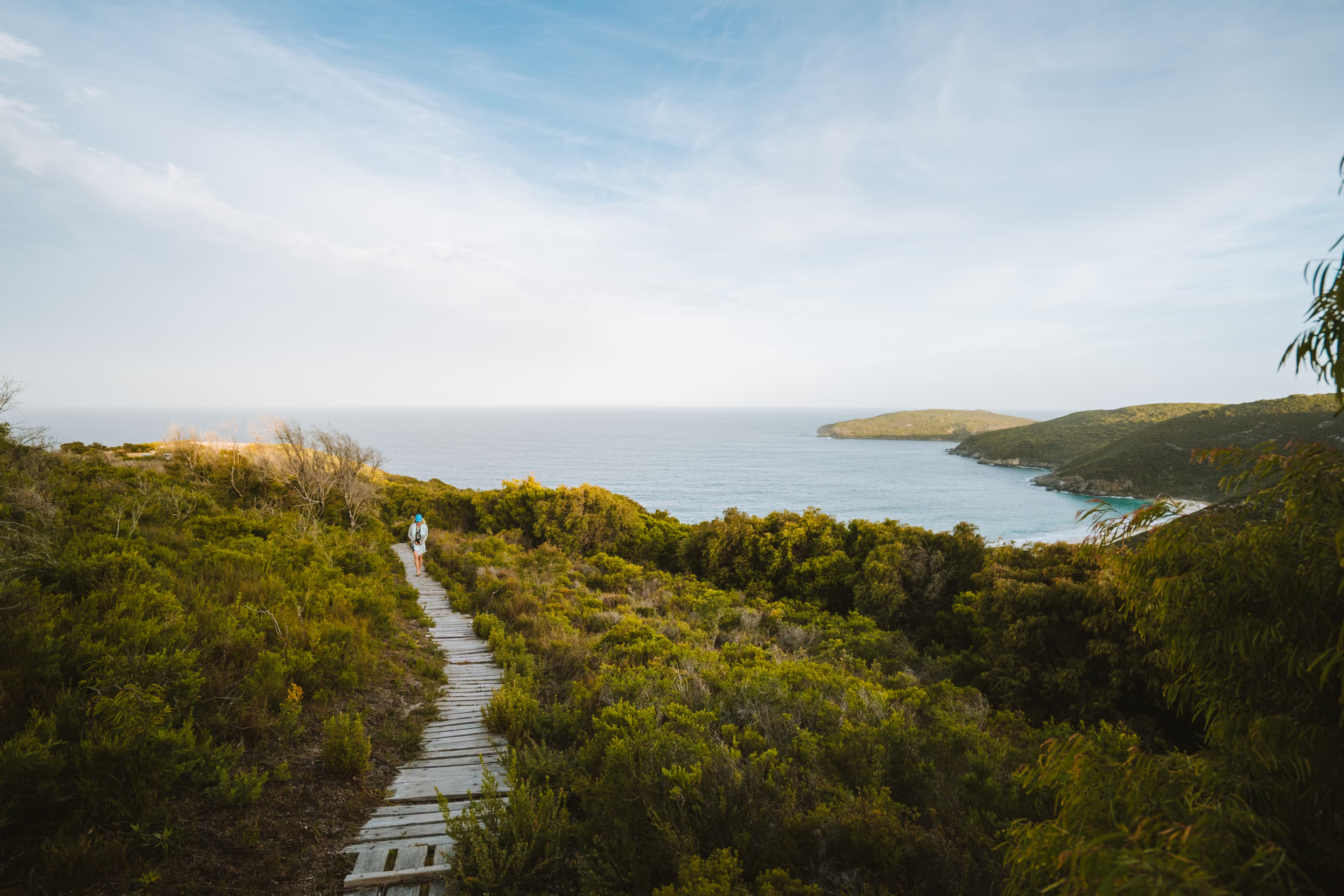
Stretching from Kalamunda, west of Perth, to Albany on the south coast of Western Australia, the Bibbulmun Track is one of Australia’s greatest long-distance hikes, often described as Australia’s answer to the eastern United States’ Appalachian Trail. Winding through the heart of the state’s South West region, the ‘Bibb’ isn’t especially difficult, just long and at times remote, with nine sections connected by nine pleasant towns offering access points for shorter walks and an opportunity to restock food supplies.
Thru-hikers may find the bush landscape repetitive at times, particularly in bushfire-affected areas, but there are plenty of highlights to keep things interesting, from towering jarrah and marri forests to wild coastlines that come into close range between Northcliffe and Walpole (section seven). Another part of the Bibb’s charm lies in the regular interactions with fellow hikers on the trail and at campsites. With a whopping 49 simple sleeping shelters dotted along the trail (available on a first-come, first-served basis), you’ll rarely need to pitch your tent.
The best time to hit the trail is from September to November, when the wildflowers are blooming, and the weather is generally fine. Long hikes between December are not recommended due to the high bushfire risk.
10. Coast Track
Best easily accessible overnight hike
26km (16 miles), 2 days, moderate
The popular Coast Track traces the dramatic coastline of the Royal National Park between Bundeena and Otford, just south of Sydney, both of which are accessible by public transport. Usually tackled in two days with an overnight at the basic North Era campground (pre-book via the NSW National Parks website, and bring your own cooking equipment), the moderately challenging trail (expect lots of steps) is typically hiked from north to south which offers the best perspectives from the soaring sandstone cliffs along the coast and keeps the sun out of your eyes.
In the cooler months from May to November, you’re likely to spot migrating whales from clifftop lookout points, while summer hikers can reward themselves with a dip at one of the numerous beaches and rockpools the trail skirts – about 2.5 hours’ walk from Bundeena, Wattamolla Beach has a glorious lagoon. There’s a kiosk at Garie Beach (before North Era Campground) typically open on weekends, but there are no official water sources along the route, so carry plenty and pack some purification tablets if you need to top up with creek water. With minimal shade on this coastal bushwalk, adequate sun protection is also vital.
11. Australian Alps Walking Track
Best alpine traverse
655km (5-8 weeks), difficult
Winding through the high country of Victoria, New South Wales and the Australian Capital Territory, the Australian Alps Walking Track traverses some of Australia’s finest alpine national parks showcasing sweeping high-altitude scenery and sites rich in history, with more than 30 mountain summits (including Mt Kosciuszko) and dozens of historic huts along the way.
An extension of the Victorian Alpine Walking Track, developed in the 1970s, the rugged and remote thru-hike combining 4WD tracks, fire trails, logging roads, old grazing paths, brumby trails (made by wild horses, which you’ll see plenty of) is designed for experienced, self-reliant bushwalkers with good navigation skills, as the trail can be difficult to follow. The route passes some ski resorts but no towns, so you’ll need to arrange food drops in advance. Expect to hike for days, even weeks, without seeing another human being.
Set out after the spring snow thaws to enjoy the wildflower season on your journey. Many people choose to walk shorter sections of the trail found in the likes of Baw Baw National Park and Alpine National Park in Victoria, Kosciuszko National Park in New South Wales and Namadgi National Park, near Canberra.
12. Great North Walk
Best urban hike
250km (160 miles), 12-18 days, moderate
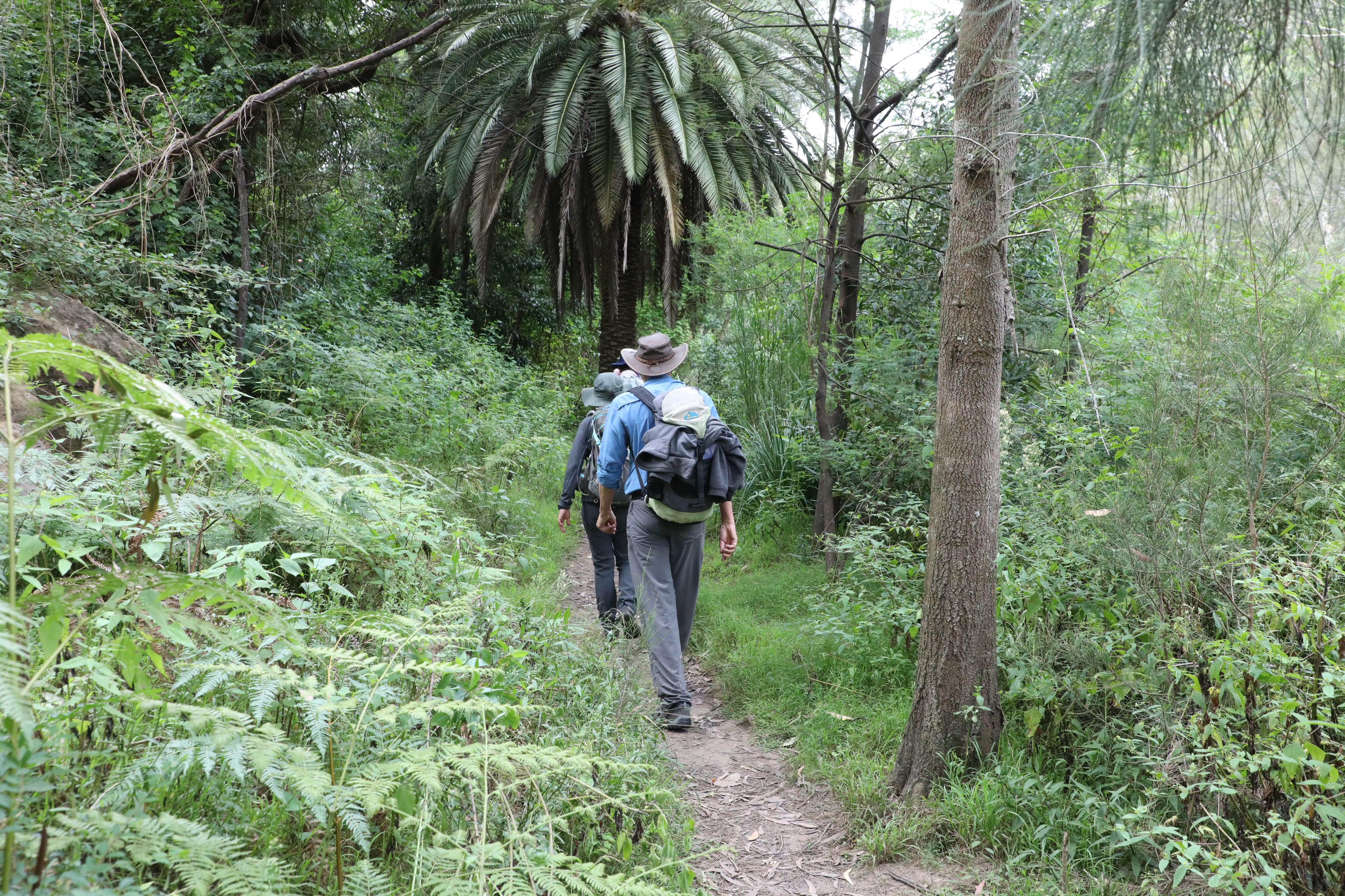
Created as part of Australia’s bicentennial celebrations in 1988, the Great North Walk connects Sydney and Newcastle, linking many of the wonderful national parks, conservation areas and other green spaces surrounding both of these coastal New South Wales cities.
The inland trail (which includes a boat trip across the Hawkesbury River) can be walked in either direction at any time of the year (though it can be very hot in summer), with overnight stays at campsites or more luxurious accommodations along the way. The entire length of the trail can alternatively be hiked as a 30-day walk.
Despite the trail skirting suburbia for most of its length and including some walking along busy roads, it’s easy to feel like you’re far from civilization on many sections, with stretches including the Benowie Walking Track in Berowra Valley National Park taking you through a spectacular natural and cultural landscape on the traditional lands of the Guringai people. Spot Aboriginal rock engravings on the Ku-ring-gai Chase National Park section, and keep your eyes peeled for wildlife along the entire route, including powerful owls, swamp wallabies, laughing kookaburras and other critters.
Tips for hiking in Australia
Before you hit Australia’s trails, make sure you’re walking in a region – and on tracks – within your realm of experience and preparation. Check with local authorities (including national park websites) for weather and track updates, and be aware that weather and seasonal changes can considerably alter the walking experience. Always tell someone where you are going and when you plan to return.
To help preserve the ecology and beauty of Australia that has been carefully managed for millennia by its traditional custodians, follow this advice:
- Carry out all your rubbish. Never bury it: digging encourages erosion, and buried rubbish will likely be dug up by animals, who may be injured or poisoned by it.
- Where a toilet isn’t available, bury your waste (including biodegradable toilet paper, but not sanitary products). Dig a small hole 15cm (6in) deep and at least 100m (320ft) from any watercourse, and cover the waste with soil and a rock. In snow, dig right down to the soil.
- Don’t use detergents or toothpaste in or near watercourses. Spit toothpaste 50m away from a river.
- For personal washing, use biodegradable soap and a water container away from watercourses. Disperse the wastewater widely to allow the soil to filter it naturally.
- Wash cooking utensils 50m from watercourses using a scourer, sand or snow instead of detergent.
- Read up on local fire regulations. With campfires banned on most Australian walking trails for at least part of the year, carry a lightweight, portable stove on multi-day hikes.
- Do not feed wildlife, as this can lead to unbalanced populations, animals becoming dependent on humans, or the spread of diseases.
- Do not remove anything from the trail as a souvenir, including rocks and seed pods.
- Pay track fees and obtain permits, especially as these are often on an honesty system, to help maintain essential services and maintenance works.
- Pack enough food and water recommended for the hike, as well as the right gear (including first aid), and know how to use it. Wearing long, lightweight clothing is ideal for protecting yourself from Australia’s harsh sun and myriad creepy crawlies.
- Stick to existing tracks and avoid shortcuts. Walking around a muddy bog only makes it bigger – plow straight through.
- Make noise when you walk to deter snakes. If you see a snake, which is common on Australian bushwalks, try and stay still to assess what it is doing before moving away slowly.
